Unfortunately neither Microsoft MapPoint, Microsoft Virtual Earth, nor Google Earth have GetAltitude(lat, long) functionality. That is, you cannot retrieve elevation data given a lat/long pair. However, NASA, the US Department of the Interior, and the US Geological Survey provide a tremendous amount of geographical/topographical data on the United States and its territories (including elevation) at this website.
For a more direct link to this data:
- Open this website: http://seamless.usgs.gov/
- Click on the View and Download United States Data (click on the map of North America in the upper right part of the webpage)
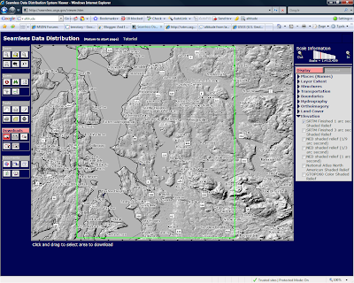
- This opens the Seamless Data Distribution Viewer. You can zoom in/out and select what features to download by drawing a bounding box over your desired region. There is a 1.5 gigabyte limit per selection. On the right side of the application, you can change what attributes the viewer is displaying.
Here's a screenshot of their tool.

1 comment:
You might want to check out the webservices from EarthTools and/or Geo-Names for elevation data.
Post a Comment